
Southeast Asia
Southeast Asia Physical Map
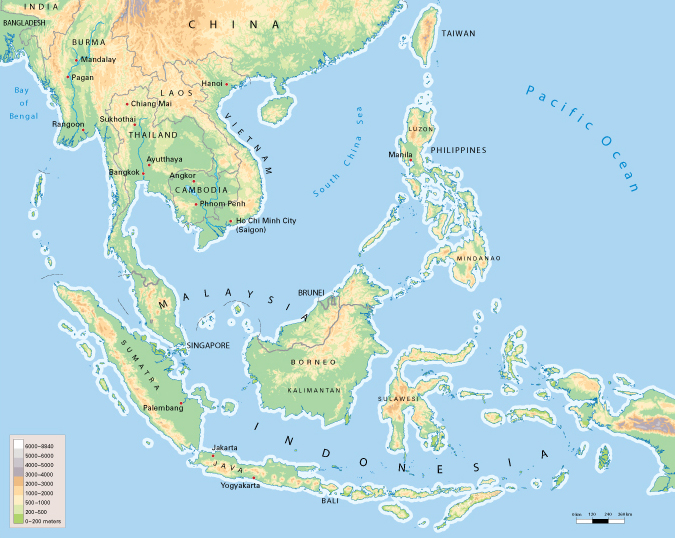
Countries in Southeast Asia
Cambodia
- Capital: Phnom Penh
- Population: 17,000,000
Indonesia
- Capital: Jakarta
- Population: 278,000,000
Laos
- Capital: Vientiane
- Population: 7,600,000
Malaysia
- Capital: Kuala Lumpur
- Population: 34,000,000
Myanmar (Burma)
- Capital: Naypyidaw*
- Population: 55,000,000
Papua New Guinea
Philippines
- Capital: Manila
- Population: 117,000,000
Singapore
- Capital: Singapore
- Population: 6,000,000
Thailand
- Capital: Bangkok
- Population: 72,000,000
Timor-Leste:
- Capital: Dili
- Population: 1,300,000
Vietnam
- Capita: Hanoi
- Population: 99,000,000
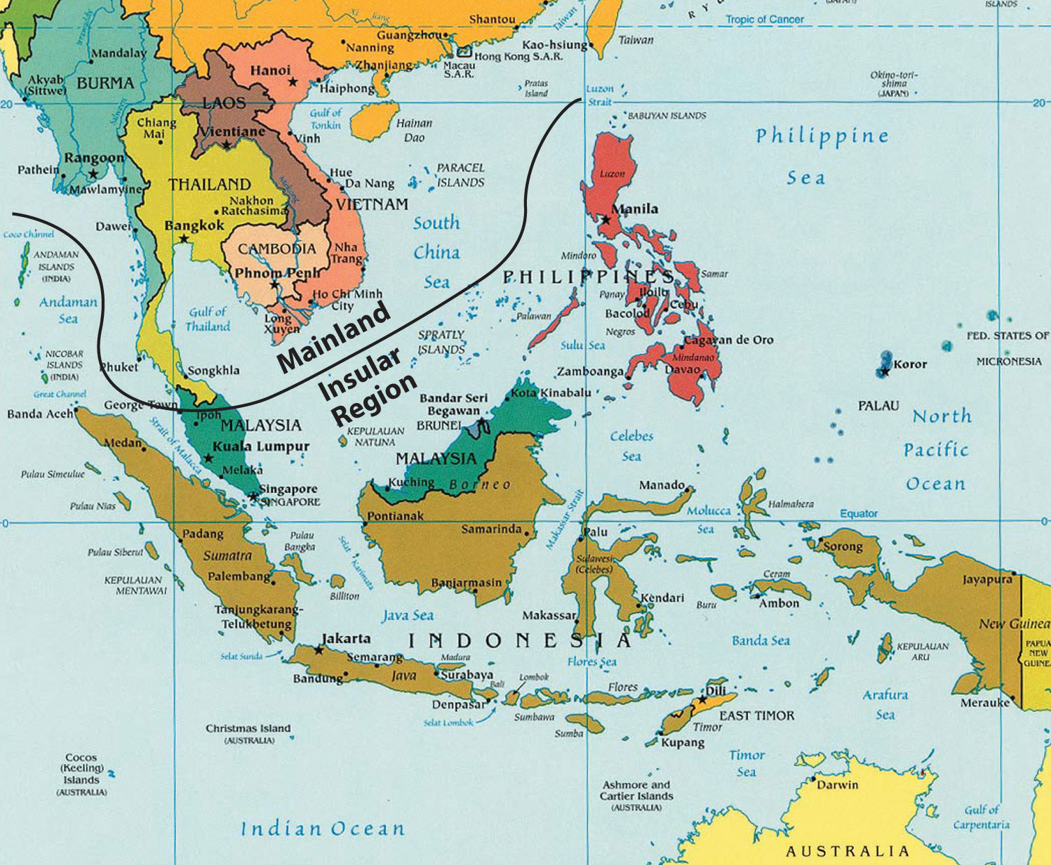
Southeast Asia Political Map
South East Asian Capitals by Population (from worldatlas.com):
Jakarta: 10,187,595
Bangkok: 8,280,925
Singapore: 5,312,400
Hanoi: 3,398,889
Phnom Penh: 2,011,725
Manila: 1,652,171
Kuala Lumpur: 1,381,830
Naypyidaw: 925,000
Port Moresby: 307,643
Vientiane: 287,579
Dili: 222,0000
 Further Reading and Investigation:
- The capital of Myanmar was changed from Rangoon to Naypyidaw in Nov. of 2005.
- Click here for an article on changing capitals
- Indonesia is currently building a new capital.
- Click here to learn more about it.
- Myanmar is currently experiencing a deadly civil war that was triggered by a 2021 coup.
- Click here to see a viral video of the 2021 unfolding (primary source) in which a woman filming herself doing a dancing routine accidentally captured footage of the country’s unfolding 2021 coup in the background.
- This primary source should be an interesting selection for both students and educators, as well as tying the contents of the page to current events.
Oceania
Hybrid Physical/Political Map of Oceania from https://www.nationsonline.org/oneworld/map/oceania_map.htm

- a region made up of thousands of islands throughout the Central and South Pacific Ocean
Countries in Oceania:
Australia
Fiji
Kiribati
Marshall Islands
Micronesia (Palikir)
Nauru
- Capital: Yaren (de facto)
New Zealand
Niue
Palau
Samoa
Solomon Islands
Tonga
Tuvalu
Vanuatu
Oceania Capitals by Population (from worldatlas.com):
Wellington: 381,900
Canberra: 354,644
Suva: 84,410
Honiara: 59,288
Apia: 39,813
Port-Vila: 38,000
Tarawa: 30,000
Majuro: 25,400
Nuku'Alofa: 22,400
Palikir: 9,900
Funafuti: 4,492
Alofi: 1,400
Further Reading and Investigation:
- At one point, much of Oceania with the exception of Tonga was under the control of foreign powers.
- Click here to learn more about colonization and imperialism in Oceania.
- Polynesians settled many of the islands of Oceania long before the arrival of European and Asian empires.
- Click here to learn more about them.
 How did the Pacific Islands’ geography affect their initial settlement by humans?
a.) The Pacific Islands were too isolated to be settled until the arrival of Europeans, who had ships capable of traveling the long distances between islands.
b.) The Pacific Islands were first settled by seafaring peoples such as the Polynesians, whose excellent navigation skills allowed them to travel between islands in canoes long before the arrival of European or Asian imperialist powers.
c.) The Pacific Islands are mostly sandy and constantly shifting with the waves, making human settlement almost impossible until the 21st century.
The correct answer is b. Seafaring peoples such as the Polynesians possessed incredible navigation skills. This allowed them to settle many islands centuries (if not thousands of years) before imperialist powers arrived, disproving option a. There is fresh water on numerous islands and they are not just sandbars shifting in the waves, so option c is incorrect as well.
Question by Jeremy Spevack (February 2024)
Sources
CIA factbook
https://www.cia.gov/library/publications/the-world-factbook/index.html
more country info
http://www.aneki.com/profiles/
more maps
U TX libraries
http://www.lib.utexas.edu/maps/cia08/new_zealand_sm_2008.gif


 World History (Massachusetts)
.png) Grades 1 - 8 (Massachusetts)
Grades 1 - 8 (Massachusetts).png)
.png)
.png)
.png)

Comments (0)
You don't have permission to comment on this page.